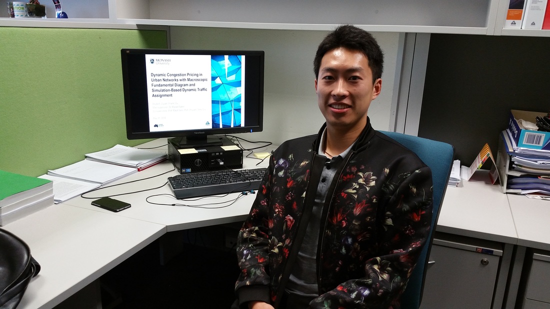
 Congratulations to Frank for successfully passing his PhD confirmation on "Dynamic Congestion Pricing with MFD and Simulation-based DTA". Frank started his PhD at Monash University in 2015 under supervision of Dr. Meead Saberi, Prof. Majid Sarvi and Prof. Zhiyuan (Terry) Liu. He received his Bachelor’s degree in Civil Engineering from Nanjing Tech University, China in 2012 and his Master’s degree in transportation engineering from SEU-Monash Joint Graduate School in China in 2013.
Abstract: Supply-oriented development of urban transportation, i.e. by road capacity expansion through large-scale construction, has been the traditional way of alleviating urban traffic congestion. However, due to limited urban space, this is not a sustainable solution anymore. Rather, demand-oriented techniques should be pursued, among which congestion pricing has been widely advocated as an effective tool in dealing with traffic congestion. An innovative solution has recently been introduced by combing congestion pricing with macroscopic traffic flow models, i.e. congestion pricing based on network fundamental diagram (NFD) or macroscopic fundamental diagram (MFD). To better reflect traffic dynamics, the broad aim of this research is to develop an optimal MFD-based congestion pricing scheme using simulation-based dynamic traffic assignment (DTA) for a large-scale real-world network (Melbourne).
0 Comments
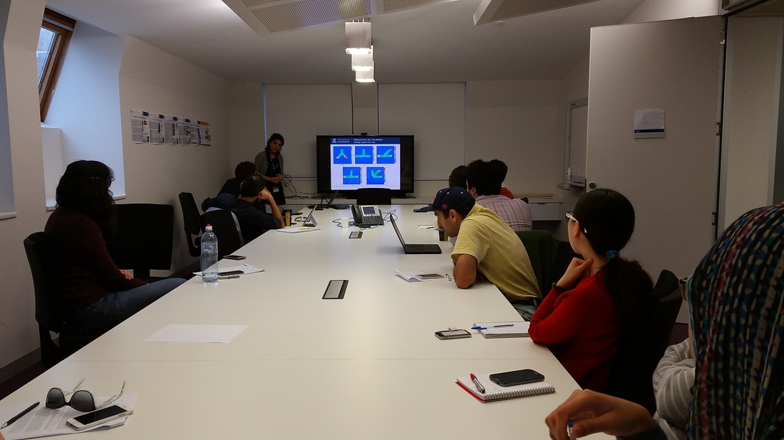 Zahra Shahhosseini is a PhD student at The University of Melbourne whom I have been co-supervising with Prof. Majid Sarvi since 2014. Her research includes studying and modeling dynamics of pedestrian crowds under panic. Zahra presented her research progress on the Impact of Conflicting Architectural Designs on Crowd Dynamics at the transportation seminar at The University of Melbourne.
Abstract: The need for developing reliable models for making simulated predictions of crowd evacuations has necessitated understanding of fundamental rules that govern human behavior during emergency escapes. One major challenge to address this particular problem, however, has been the lack of experimental data of panicked humans in which speeds and desire to flee are taken to extremes. This presentation reports on a research study with ultimate aim of developing such forecast tools which is capable of capturing human interactions with physically or psychologically complex environmental settings based on concrete empirical evidence. In this study, we utilize two types of empirical data, one obtained from experiments with biological entities and the other from experiments with human. This presentation will report on the findings corresponding to the understanding of the impact of conflicting geometries (i.e. merging sections) on human and non-human entities collective movements based on macroscopic level analyses of the data derived from those experiments.
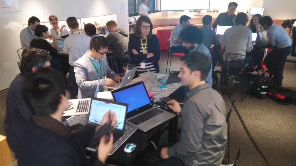
Last few weeks have been a busy data hack time for us. Julian, Bryan and Emily participated in the Melbourne Datathon 2016. The team city science is now in the list of the top 5 finalists. This time we are focusing on the employment data across Australia, visualizing data on number, variety and popularity of jobs in urban areas. See a demo of the project here: http://www.jmily.net/datathon2016/web/ 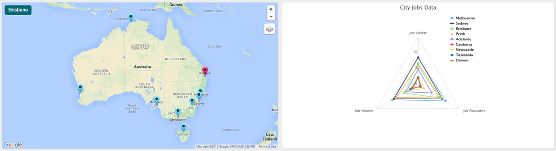 CityX team participated at the ARUP Open Data House as part of the Melbourne Knowledge Week 2016. Arup and a select group of data providers opened up a curated set of rarely seen transport and urban data from Melbourne. Data scientists, city and transport planners, and designers were invited to analyse and help solve a critical urban problem using these exciting data sets.
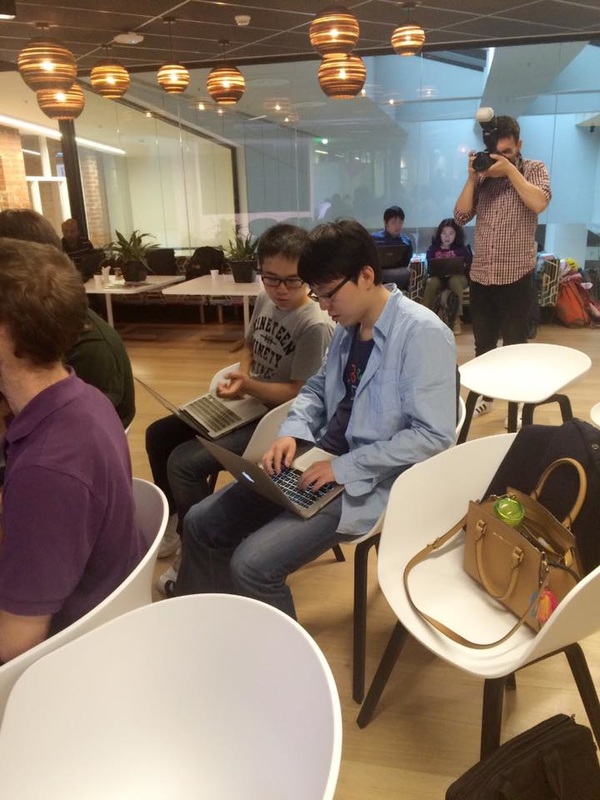
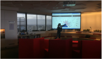
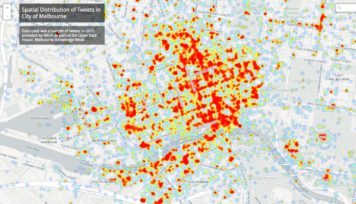
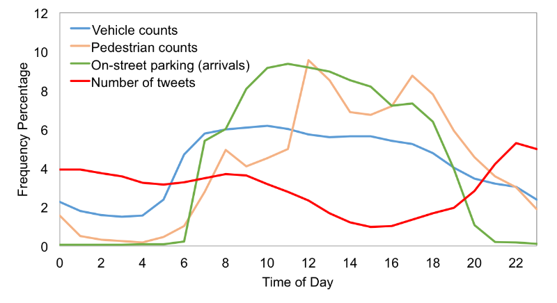
We were invited to present some of our previous data visualizations to inspire participants for a productive afternoon. Later, we also participated in the competition with a project looking at "How do people use the city? Comparing temporal variation of pedestrian activities, on-street parking usage, traffic volumes, and tweets in Melbourne." We put together an imperfect comparative analysis of time-series data from tens of pedestrian count sensors (1.1M+ rows), thousands of in-ground parking bay sensors (1M+ rows), traffic counts from several bluetooth detectors (2M+ rows), and thousands of tweets from Twitter (250K+). The map on the cover shows the spatial distribution of tweets in City of Melbourne. The goal was to better understand how people use the city over time of day using available open data. We were specifically interested to find whether there is any correlation between the temporal variation of some of the data we had. In 2-3 hours, we put together a simple analysis and here are our findings.
Pedestrian activities in the city do not seem to have a strong correlation with vehicle counts and on-street parking usage during the day. While distribution of vehicle counts is decreasing with a small slope from 7 am to 5 pm, pedestrian activities are increasing with three sharp peaks at 8 am, 12 pm, and 5 pm. This is probably due to the fact that a large fraction of people traveling to CBD use public transport.
Special thanks to Bryan, Sajjad, Frank, and Domenico. We are seeking highly motivated and talented applicants contributing to our growing multidisciplinary research in transportation engineering. Applicants should hold a Master's degree in Civil Engineering, Electrical Engineering, Computer Science, Information Technology, Operations Research, Applied Mathematics, or Physics and should be interested in transportation systems research. Preferred background and experience include traffic modeling, transportation network modeling, stochastic analysis, optimization, machine learning, and big data. A summary of the project description is provided below. Potential applicants are encouraged to contact Dr. Meead Saberi, submitting their complete CV and contact information for three references. The position is available immediately. The call for applications will remain open until the position is filled. The PhD scholarship is provided by NICTA.
Project Summary Urbanization and recent wide-spread advancements of information and communication technologies have transformed cities into pools of big data, providing new opportunities to unravel hidden patterns in urban life. However, using big data to generate "smarter cities" relies on the methodological capacity to render the masses of data into meaningful and, most importantly, useful information. Government organisations that manage and operate transport networks have a critical need for reliable and accurate traffic estimation and prediction tools. This project aims to develop a framework to integrate multiple data sources including traffic, weather, crashes, work zones, special events, and social media for a better predictive modelling of traffic congestion at the network level. The new modelling approach takes advantage of machine learning and big data analytics considering spatial and temporal interdependencies of traffic condition in a large-scale network. Results are expected to help government agencies to better predict traffic congestion and thus, manage the transport network more effectively. Monash Supervisors Dr. Meead Saberi (Faculty of Engineering, Monash University) Dr. Mohsen Ramezani (Faculty of Engineering, Monash University) NICTA Supervisor Dr. Goce Ristanoski |
AuthorDr. Meead Saberi, lecturer in transportation engineering, data guru, and urban scientist Archives
May 2019
Categories |

 RSS Feed